Köppen climate zones of Spain, journal-ready
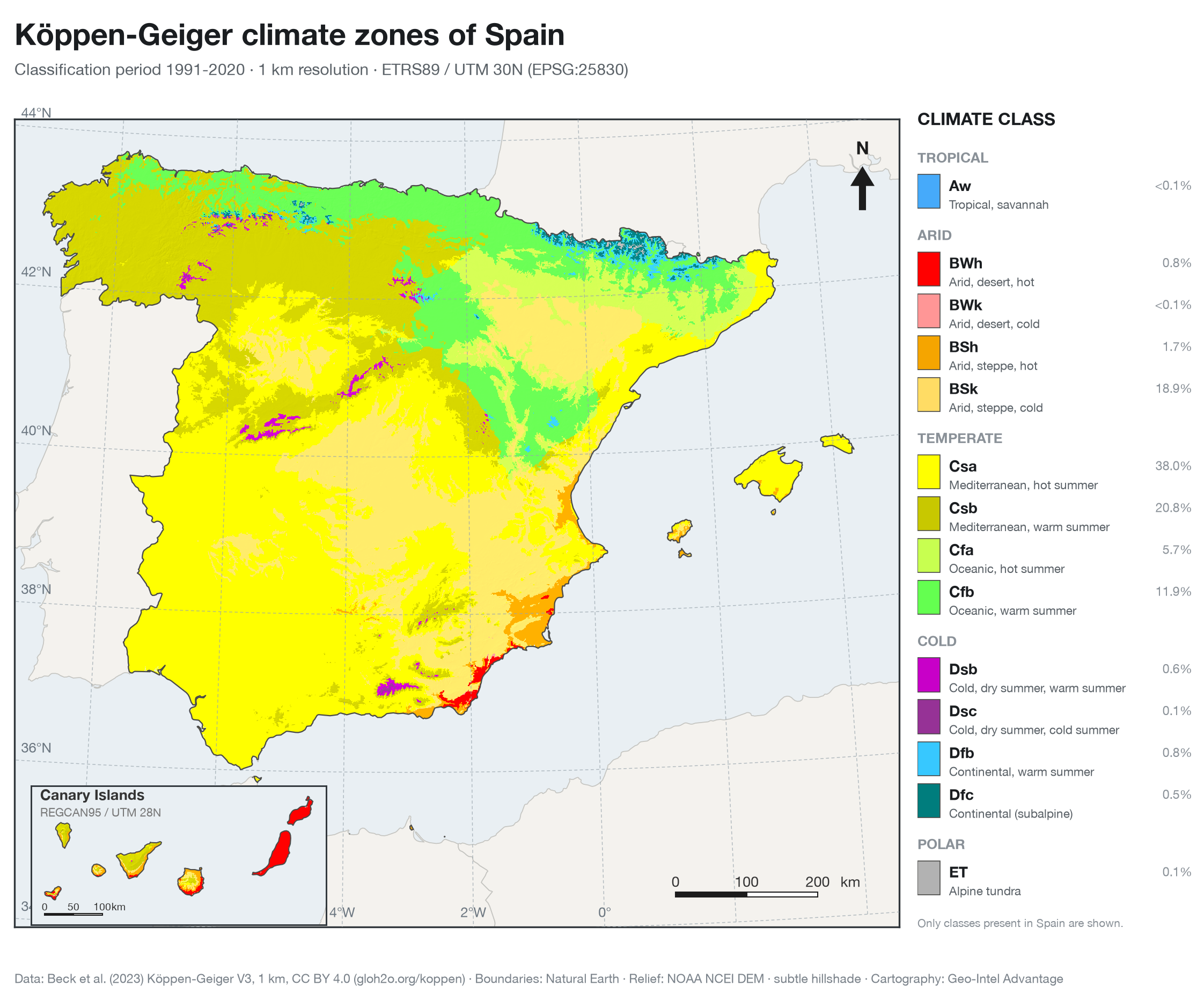
A publication-grade climate-zone map of Spain (peninsula, Balearics and the Canary Islands) built from the Köppen-Geiger 1 km classification, 1991-2020. Exported at 300 DPI as PNG and print PDF by a reproducible QGIS-compatible Python pipeline.
Real Köppen-Geiger V3 data · CC BY 4.0
View
Climate classes in Spain
Figure spec
Figure size190 × 158 mm · 300 DPI
ProjectionETRS89 / UTM 30N (EPSG:25830)
Canaries insetREGCAN95 / UTM 28N
ClassificationKöppen-Geiger V3 · 1991–2020
Resolution1 km (0.00833°)
Data licenceCC BY 4.0 · Beck et al. 2023
Rendered offline by pipeline/spain_climate.py (rasterio + GeoPandas) from the Köppen-Geiger V3 1 km GeoTIFF (Beck et al. 2023, CC BY 4.0) and Natural Earth boundaries, with a subtle NOAA DEM hillshade. The interactive layer is the same classification, vectorised. No live APIs beyond basemap tiles.
scroll to zoom · drag to pan · double-click to reset